Trail Walking Le Ferré - Le Ferré_Pors aux chouans - Photo

Le Ferré_Pors aux chouans

© OpenStreetMap contributors
Length
Length
4.7 km
Max alt
Max alt
154 m
Uphill gradient
Uphill gradient
46 m
Km-Effort
Km-Effort  
5.3 km
Min alt
Min alt
124 m
Downhill gradient
Downhill gradient
48 m
Boucle
Boucle
Yes
Creation date :
2016-04-22 00:00:00.0
Updated on :
2016-04-22 00:00:00.0

(0 Reviews)

Walking
Walking
1h10
Difficulty : Easy

Scan this QR Code to open this trail in the SityTrail application

FREE GPS app for hiking

Logo SityTrail SityTrail

IGN / Geographical institutes

Download SityTrail from the App Store Download SityTrail from Google Play

Logo SityTrail SityTrail World

The world is yours!

Download SityTrail from the App Store Download SityTrail from Google Play Download SityTrail on Huawei AppGallery

About

Trail Walking of 4.7 km to be discovered at Brittany, Ille-et-Vilaine, Le Ferré. This trail is proposed by neoroll44.

Description

Circuit du pors aux chouans (jaune).
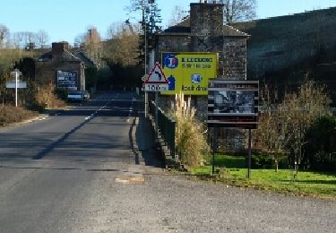
Départ parking de la Mairie. La Mairie derrière soi,
prendre la départementale vers la droite direction
Fougères sur 50 m puis tourner à gauche direction
des Vallées. Au bout du chemin tourner dans chemin
de terre à droite.
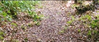
Suivre le chemin qui traverse un ruisseau puis un bosquet. Prendre ensuite à gauche pour emprunter un long chemin creux, autrement
nommé « pors » qui n’est autre que le fameux « pors aux Chouans ».
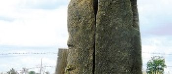
Au bout du chemin creux rejoindre le sentier. Prendre à gauche au carrefour suivant. Traverser un champ et rejoindre le hameau de Dimaigné.
À la sortie du hameau prendre un chemin bordé d’arbres sur la droite, et rejoindre La Grifferais.
Une fois La Grifferais traversée suivre le balisage pour retourner vers le bourg de Le Ferré. Prendre à droite après Les Vallées, puis à gauche pour rejoindre le bourg.

Elevation profile

Photos

Points of interest

Point of interest Le Ferré - Le pors aux Chouans - Photo
neoroll44
Point of interest Le Ferré - Sculptures - Photo
neoroll44
LE FERRÉ 

Positioning

Country:
France
Region :
Brittany
Department/Province :
Ille-et-Vilaine
Municipality :
Le Ferré
Location:
Unknown
Start:(UTM)
626004 ; 5372491 (30U) N.

Trails nearby

Trail Walking Saint-Georges-de-Reintembault - De la toile à l'agriculture (10 kms) - Saint Georges de Reintembault - Photo
Walking
tracegps

Walking

Medium
Saint-Georges-de-Reintembault, Brittany, Ille-et-Vilaine, France
10.7 km | 12.1 km-effort
2h 40min
Yes
Trail Walking Saint-Georges-de-Reintembault - De la toile à l'agriculture (7 kms) - Saint Georges de Reintembault - Photo
Walking
tracegps

Walking

Easy
Saint-Georges-de-Reintembault, Brittany, Ille-et-Vilaine, France
7.3 km | 8.1 km-effort
1h 49min
Yes
Trail Running Saint-James - Cani cross Rainette - Photo
Running
Giran

Running

Medium
Saint-James, Normandy, Manche, France
8.9 km | 10.8 km-effort
54min
No
Trail Nordic walking Saint-James - stjames 10km - Photo
Nordic walking
coglais

Nordic walking

Medium
Saint-James, Normandy, Manche, France
10.1 km | 12.9 km-effort
2h 36min
Yes
Trail Walking Saint-Georges-de-Reintembault - St-Georges de Reintembault - Photo
Walking
neoroll44

Walking

Medium
Saint-Georges-de-Reintembault, Brittany, Ille-et-Vilaine, France
9.2 km | 10.2 km-effort
2h 20min
Yes
Trail Walking Saint-James - Saint James / Fougères - Photo
Walking
cstegch

Walking

Easy
Saint-James, Normandy, Manche, France
29 km | 34 km-effort
Unknown
No
Trail Running Saint-James - De Saint James à Saint Benoit - Photo
Running
tracegps

Running

Very difficult
Saint-James, Normandy, Manche, France
8.2 km | 10.7 km-effort
1h 0min
Yes
Trail Mountain bike Saint-James - De Saint James à Saint Benoit - Photo
Mountain bike
tracegps

Mountain bike

Difficult
Saint-James, Normandy, Manche, France
8.2 km | 10.7 km-effort
45min
Yes
Trail Walking Saint-James - De Saint James à Saint Benoit - Photo
Walking
tracegps

Walking

Difficult
Saint-James, Normandy, Manche, France
8.2 km | 10.7 km-effort
2h 0min
Yes


Close
My subscriptions